GFS maps: Italy, Last 4 GFS run comparison
GFS maps for Italy : Last 4 GFS run comparison
The weather maps on this page are created and owned by firenzemeteo.it. You can use them on other websites
or on publications always quoting firenzemeteo.it as a reference. It is forbidden to modify the maps.
To see the GFS ANALYSIS MAP ARCHIVE
from 2013 to today click on the red link.
Click to choose the geographical area
The selected area is highlighted in green.
Click to choose the weather map
The selected area is highlighted in green. Some map types are not available for certain areas.
MapCode: 20
| Geop.+Temp. 500 hPa | 2 m Temperature | 500 hPa Temp. Anomalies | Rain & Snow + 0 C Level | 10 m Wind | Cloud Cover |
| Geop. + Temp. 500 hPa (GIF) | Minimum Temperature | 2 m Temp. Anomalies | 1 Day Total Precipitation | 500 hPa Wind | CAPE & Lifted Index |
| Geop.+Temp. 850 hPa | Maximum Temperature | Daily 2 m Average Temp. | Precipitable Water | 200 hPa Jet Stream | CIN |
| Geop. + Temp. 850 hPa (GIF) | 2 m Temp. trend | Daily 2 m Temp. Anomalies | RH + Vertical Vel. 850 hPa | 300 hPa Jet Stream | 500 hPa Forecast Stability |
| Geop.+Temp. 925 hPa | 850 hPa Temp. trend | Daily 850 hPa Average Temp. | RH + Vel. Verticale 700 hPa | 850 hPa Forecast Stability | |
| 500 hPa Geop. + Temp. trend | 850 hPa Temp. Anomalies | Daily 850 hPa Temp. Anomalies | RH + Vel. Verticale 500 hPa | Last 4 GFS run comparison |
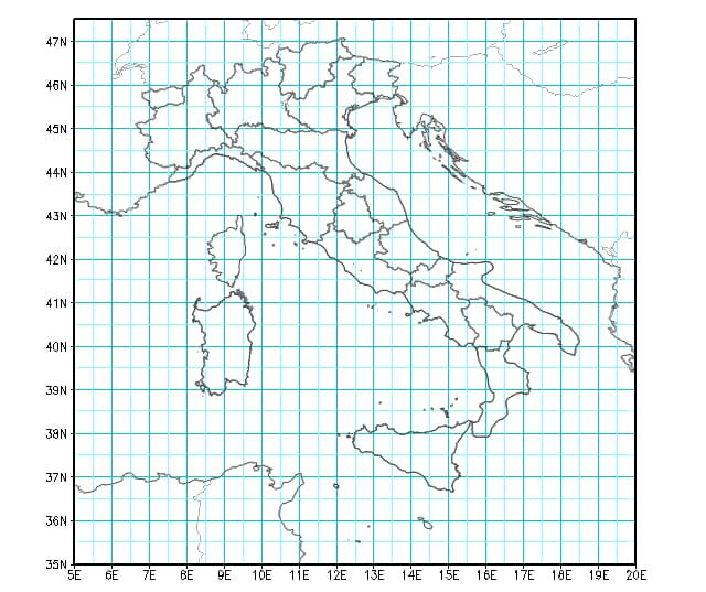
GFS Italy: Last 4 GFS run comparison
Click on the map to create a comparison plot of the last 4 GFS forecast runs.
For each run, temperatures (in °C) at 850 hPa (about 1300 m asl) and precipitation (in mm) are shown. Temperature values on the left axis,
while those of precipitation on the right axis. For temperatures, a red line shows the 1979-2008 climatological mean temperature (source: NOAA)
for the selected point on the grid.
NOTE: in central European countries, when solar time is in effect, the CET time is used, which is equal to UTC +1 hour, while when daylight saving time is in effect, the CEST time is used, which is equal to UTC +2 hours. Right now it is 1:31 UTC.

Notes on GFS forecast maps
The Global Forecast System (GFS) is a National Centers for Environmental Prediction (NCEP)
weather forecast model that generates data for dozens of atmospheric and land-soil variables,
including temperatures, winds, precipitation, soil moisture, and atmospheric ozone concentration.
The system couples four separate models (atmosphere, ocean model, land/soil model, and sea ice) that work
together to accurately depict weather conditions.
GFS is a global model with a base horizontal resolution of 0.25° (28 kilometers) between grid points.
The GFS is run 4 times a day, the temporal resolution covers analysis and forecasts out to 16 days.
See the GFS analysis maps archive from 2013 to today
To see the GFS ANALYSIS MAP ARCHIVE from 2013 to today click on the red link.