
Flood level of the rivers in Tuscany
Hydrometry of rivers and streams in Tuscany
Real-time monitoring of river flood levels in Tuscany. The diagrams have been divided by areas and basins.
Alert Level 2 · 2nd threshold exceeded 0
No stations exceeding the 2nd warning threshold.
Alert Level 1 · 1st threshold exceeded 0
No stations exceeding the 1st warning threshold.
Watchlist · Rising water level (↑) 2
Map of all hydrometric monitoring stations in Tuscany
Click on the river wave markers to view hydrometric station details (current water level, trend and last update). The map displays stations.
Map Legend
- ● Blue: Normal water level, below warning thresholds.
- ● Yellow: 1st warning threshold exceeded (Alert Level 1).
- ● Red: 2nd warning threshold exceeded (Alert Level 2).
- ✨ Blinking: Indicates that the water level is currently rising (upward trend).
Monitoring stations in the basin of the Arno river
Below are the charts of the hydrometric monitoring stations in the basin of the Arno river.
River level: Arno at Stia (AR) 1.01 m

River level: Arno at Subbiano (AR) 1.45 m

River level: Arno at Laterina-Pergine (AR), Ponte Romito 4.42 m
Click here to open the dedicated page for Laterina-Pergine (AR), Ponte Romito.

River level: Arno at Montevarchi (AR) 0.67 m

River level: Arno at Incisa (FI) 1.32 m ↓

River level: Arno at Pontassieve/Rosano (FI), stazione a monte 0.49 m ↑
Click here to open the dedicated page for Pontassieve/Rosano (FI), stazione a monte.

River level: Arno at Pontassieve (FI), stazione a valle 2.25 m
Click here to open the dedicated page for Pontassieve (FI), stazione a valle.

River level: Arno at Firenze (zona Uffizi) 1.09 m
Click here to open the dedicated page for Firenze (zona Uffizi).

River level: Arno at Ponte a Signa (FI) 1.42 m
Click here to open the dedicated page for Ponte a Signa (FI).

River level: Arno at Montelupo (FI) 2.02 m
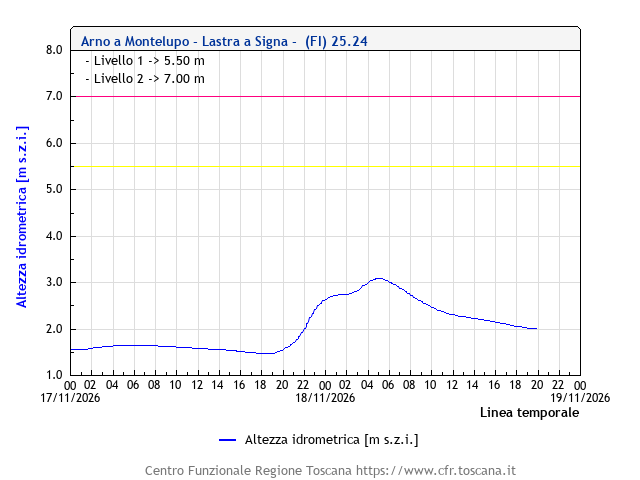
River level: Arno at Empoli (FI) -4.74 m ↓

River level: Arno at Fucecchio (FI) -4.50 m ↓
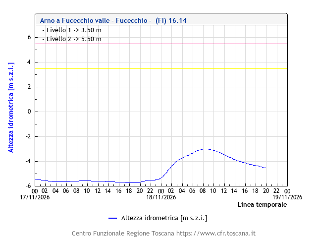
River level: Arno at Pontedera (PI) 0.24 m ↓

River level: Arno at San Giovanni alla Vena, Vicopisano (PI) 1.61 m ↓
Click here to open the dedicated page for San Giovanni alla Vena, Vicopisano (PI).

River level: Arno at Pisa 1.29 m ↓

River level: Arno at San Giovanni alla Vena, Vicopisano (PI) 1.60 m ↓
Click here to open the dedicated page for San Giovanni alla Vena, Vicopisano (PI).
River level: Arno at Bocca d'Arno, Pisa 1.19 m ↑
Click here to open the dedicated page for Bocca d'Arno, Pisa.

River level: Carza at San Piero a Sieve (FI) 1.37 m
Click here to open the dedicated page for San Piero a Sieve (FI).

River level: Sieve at San Piero a Sieve (FI) 0.86 m
Click here to open the dedicated page for San Piero a Sieve (FI).

River level: Sieve at Dicomano (FI) 0.60 m

River level: Sieve at Rufina (FI), Fornacina 1 1.27 m ↓
Click here to open the dedicated page for Rufina (FI), Fornacina 1.

River level: Sieve at Rufina (FI), Fornacina 2 1.25 m ↓
Click here to open the dedicated page for Rufina (FI), Fornacina 2.

River level: Mugnone at Firenze (Ponte alle Mosse 0.56 m
Click here to open the dedicated page for Firenze (Ponte alle Mosse.
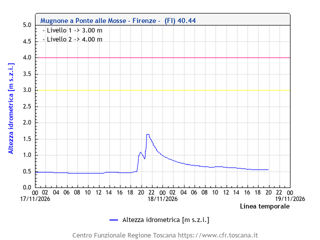
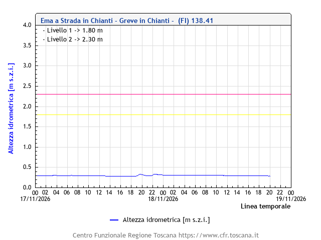
River level: Greve at Greve in Chianti (FI) 0.41 m
Click here to open the dedicated page for Greve in Chianti (FI).
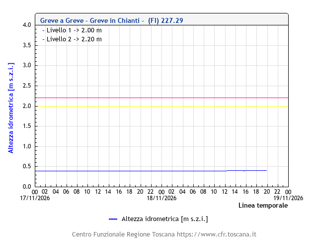
River level: Greve at Tavernuzze (FI) 0.31 m

River level: Greve at Scandicci (FI) 0.07 m

River level: Ema at Ema in Chianti (FI) 0.28 m
Click here to open the dedicated page for Ema in Chianti (FI).
River level: Ema at Grassina (FI) 0.36 m

River level: Ema at Ponte a Niccheri, Bagno a Ripoli (FI) 0.47 m
Click here to open the dedicated page for Ponte a Niccheri, Bagno a Ripoli (FI).

River level: Bisenzio at Gamberame, Vaiano (PO) 0.61 m
Click here to open the dedicated page for Gamberame, Vaiano (PO).

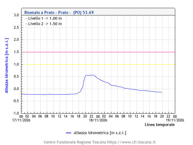
River level: Bisenzio at Prato -0.13 m
River level: Bisenzio at San Piero a Ponti (FI) 2.02 m
Click here to open the dedicated page for San Piero a Ponti (FI).

River level: Ombrone Pistoiese at Pistoia, pontelungo 0.84 m
Click here to open the dedicated page for Pistoia, pontelungo.

River level: Ombrone Pistoiese at Ponte alle Vanne (PO) -0.01 m
Click here to open the dedicated page for Ponte alle Vanne (PO).

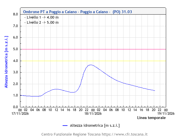
River level: Ombrone Pistoiese at Poggio a Caiano (PO) 1.47 m ↓
Click here to open the dedicated page for Poggio a Caiano (PO).
River level: Stella at Quarrata (PT) 0.34 m

River level: Brana at Agliana (PT) 0.85 m

River level: Calice at Agliana (PT) 0.61 m

River level: Ambra at Ambra, Bucine (AR) 0.32 m
Click here to open the dedicated page for Ambra, Bucine (AR).

River level: Ambra at Bucine (AR) 0.57 m

River level: Pesa at Sambuca Val di Pesa (FI) 0.82 m
Click here to open the dedicated page for Sambuca Val di Pesa (FI).

River level: Pesa at Turbone-Montelupo (FI) 1.37 m
Click here to open the dedicated page for Turbone-Montelupo (FI).

River level: Virginio at Montespertoli (FI) 0.04 m
Click here to open the dedicated page for Montespertoli (FI).

River level: Virginio at Empoli (FI) -0.23 m

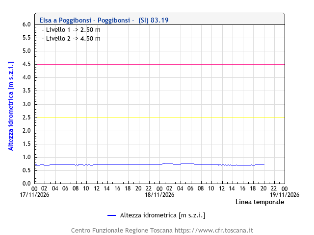
River level: Elsa at Poggibonsi (PI) 0.72 m
River level: Elsa at Certaldo (FI) 0.33 m

River level: Elsa at Castelfiorentino (FI) -0.16 m
Click here to open the dedicated page for Castelfiorentino (FI).

River level: Elsa at Ponte a Elsa (FI) 0.94 m
Click here to open the dedicated page for Ponte a Elsa (FI).

River level: Egola at Fornacino, San Miniato (PI) 0.04 m
Click here to open the dedicated page for Fornacino, San Miniato (PI).

River level: Era at Capannoli (PI) 2.31 m

River level: Era at Molino d'Era, Volterra (PI) 0.47 m
Click here to open the dedicated page for Molino d'Era, Volterra (PI).
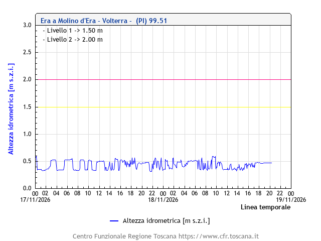
River level: Era at Ponsacco (PI) 0.23 m

River level: Roglio at Forcoli, Palaia (PI) 0.33 m
Click here to open the dedicated page for Forcoli, Palaia (PI).

River level: Tora at Collesalvetti (FI) 0.41 m
Click here to open the dedicated page for Collesalvetti (FI).
River level: Marina at Calenzano 0.34 m

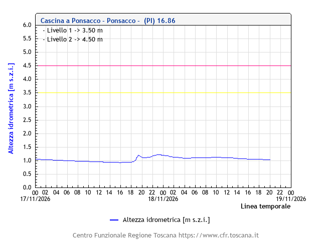
River level: Cascina at Ponsacco (PI) 1.04 m
Monitoring stations in the basin of the Cecina and other rivers in Pisa and Livorno provinces
Below are the charts of the hydrometric monitoring stations in the basin of the Cecina and other rivers in Pisa and Livorno provinces.
River level: Cecina at Cecina (LI) 0.34 m

River level: Cecina at Masso degli Specchi, Castelnuovo Val di Cecina (PI) 0.25 m
Click here to open the dedicated page for Masso degli Specchi, Castelnuovo Val di Cecina (PI).
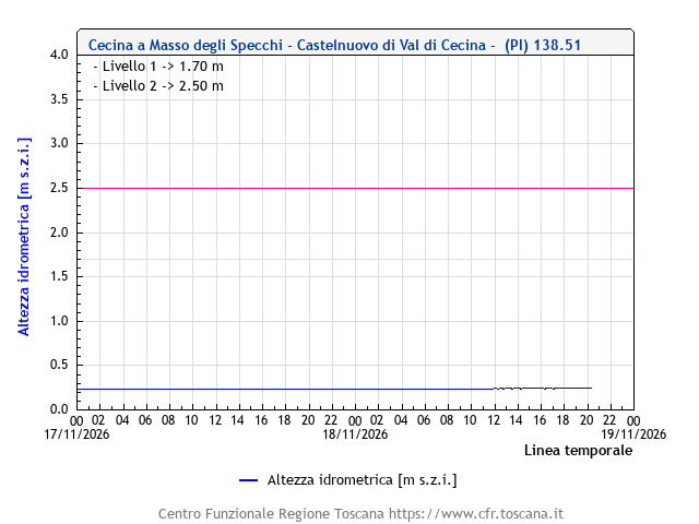
River level: Cecina at Pomarance (PI)
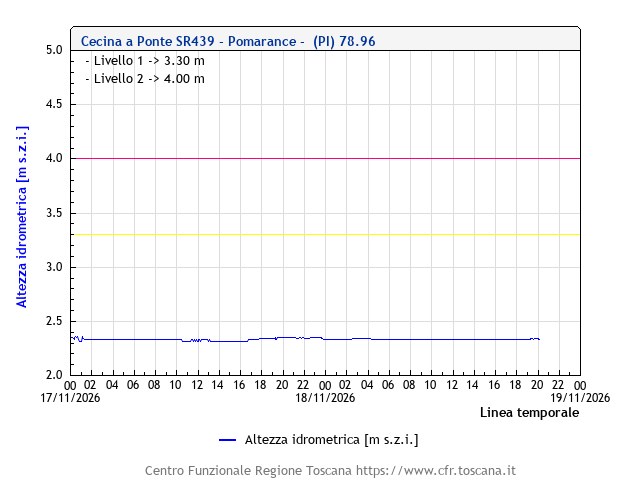
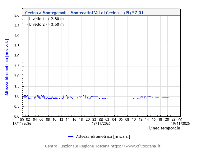
River level: Cecina at Montegemoli, Montecatini Val di Cecina (PI) 0.95 m
Click here to open the dedicated page for Montegemoli, Montecatini Val di Cecina (PI).
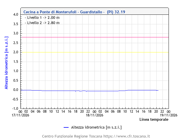
River level: Cecina at Ponte di Monterufoli, Guardistallo (PI) -0.02 m
Click here to open the dedicated page for Ponte di Monterufoli, Guardistallo (PI).
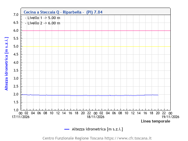
River level: Cecina at Steccaia, Riparbella (PI) 1.96 m
Click here to open the dedicated page for Steccaia, Riparbella (PI).
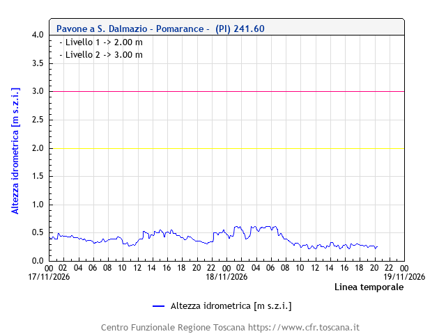
River level: Pavone at San Dalmazio, Pomarance (PI) 0.27 m
Click here to open the dedicated page for San Dalmazio, Pomarance (PI).
River level: Sterza at Case Grisella,Guardistallo (PI) 0.59 m
Click here to open the dedicated page for Case Grisella,Guardistallo (PI).

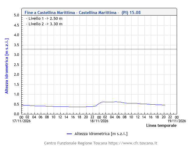
River level: Fine at Castellina Marittima (PI) 0.46 m
Click here to open the dedicated page for Castellina Marittima (PI).
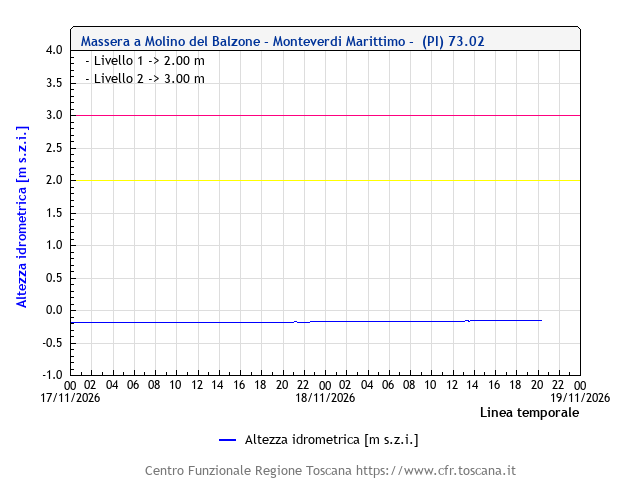
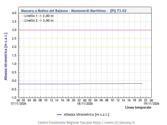
River level: Massera at Molino del Balzone, Monteverdi Marittimo (PI) -0.16 m
Click here to open the dedicated page for Molino del Balzone, Monteverdi Marittimo (PI).
River level: Milia at Calzalunga, Suvereto (LI) -0.27 m
Click here to open the dedicated page for Calzalunga, Suvereto (LI).

River level: Cornia at Lodano, Monteverdi Marittimo (PI) 0.36 m
Click here to open the dedicated page for Lodano, Monteverdi Marittimo (PI).

River level: Cornia at Ponte per Montoni, Suvereto (LI) 0.48 m
Click here to open the dedicated page for Ponte per Montoni, Suvereto (LI).
River level: Cornia at Cafaggio, Campiglia Marittima (LI) -0.80 m
Click here to open the dedicated page for Cafaggio, Campiglia Marittima (LI).

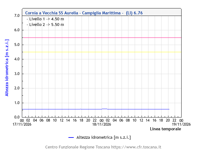
River level: Cornia at Campiglia Marittima (LI) 0.57 m
Click here to open the dedicated page for Campiglia Marittima (LI).
Monitoring stations in the basin of the Magra and Versilia rivers
Below are the charts of the hydrometric monitoring stations in the basin of the Magra and Versilia rivers.
River level: Magra at Piccatello, Pontremoli (MS) 0.23 m
Click here to open the dedicated page for Piccatello, Pontremoli (MS).

River level: Magra at S. Giustina, Pontremoli (MS) -1.12 m
Click here to open the dedicated page for S. Giustina, Pontremoli (MS).
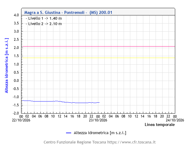
River level: Magra at Ponte di Magra, Villafranca in Lunigiana (MS) 0.97 m
Click here to open the dedicated page for Ponte di Magra, Villafranca in Lunigiana (MS).

River level: Magra at Calamazza, Aulla (MS) 1.23 m ↓
Click here to open the dedicated page for Calamazza, Aulla (MS).

River level: Teglia at Ponte di Teglia, Pontremoli (MS) 0.89 m
Click here to open the dedicated page for Ponte di Teglia, Pontremoli (MS).

River level: Bagnone at Bagnone (MS) 0.26 m
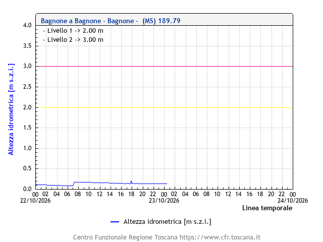
River level: Taverone at Licciana Nardi (MS) 0.70 m
Click here to open the dedicated page for Licciana Nardi (MS).

River level: Aulella at Soliera, Fivizzano (MS) 1.97 m
Click here to open the dedicated page for Soliera, Fivizzano (MS).

River level: Carrione at Torano, Carrara (MS) 0.16 m
Click here to open the dedicated page for Torano, Carrara (MS).

River level: Carrione at Pesa Miseglia, Carrara (MS) 0.42 m
Click here to open the dedicated page for Pesa Miseglia, Carrara (MS).

River level: Carrione at Colonnata Valle, Carrara (MS) 0.16 m
Click here to open the dedicated page for Colonnata Valle, Carrara (MS).

River level: Carrione at Carrara (MS) 0.63 m

River level: Carrione at Carrara (MS), Ponte della Bugia -0.86 m
Click here to open the dedicated page for Carrara (MS), Ponte della Bugia.
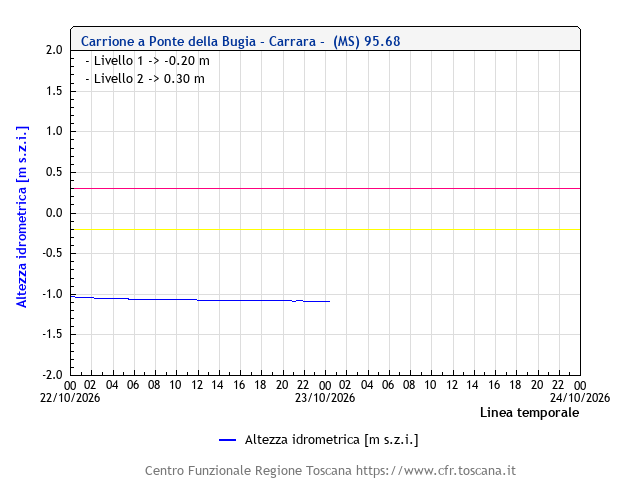
River level: Carrione at Avenza (MS) 1.54 m

River level: Gragnana at Santuario della Salute, Carrara (MS) 0.28 m
Click here to open the dedicated page for Santuario della Salute, Carrara (MS).

River level: Ricortola at Ricoltola, Massa Carrara (MS) 0.19 m
Click here to open the dedicated page for Ricoltola, Massa Carrara (MS).

River level: Frigido at Canevara, Massa (MS) -0.26 m ↓
Click here to open the dedicated page for Canevara, Massa (MS).

River level: Vezza at Ruosina, Stazzema (LU) 0.54 m
Click here to open the dedicated page for Ruosina, Stazzema (LU).

River level: Versilia at Seravezza (LU), monte 1.28 m
Click here to open the dedicated page for Seravezza (LU), monte.

River level: Versilia at Seravezza (LU), valle 2.42 m ↓
Click here to open the dedicated page for Seravezza (LU), valle.
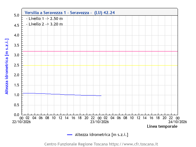
River level: Versilia at Ponte Tavole, Seravezza (LU) 1.68 m
Click here to open the dedicated page for Ponte Tavole, Seravezza (LU).

River level: Baccatoio at Baccatoio (LU) 1.30 m ↓

River level: Camaiore at Camaiore (LU) -0.01 m

River level: Burlamacca at Viareggio (LU), stazione 1 0.28 m
Click here to open the dedicated page for Viareggio (LU), stazione 1.

River level: Burlamacca at Viareggio (LU), stazione 2 0.55 m ↓
Click here to open the dedicated page for Viareggio (LU), stazione 2.

Monitoring stations in the basin of the Grosseto Ombrone and other rivers in the province
Below are the charts of the hydrometric monitoring stations in the basin of the Grosseto Ombrone and other rivers in the province.
River level: Ombrone at Ponte del Garbo, Asciano (SI) 0.46 m
Click here to open the dedicated page for Ponte del Garbo, Asciano (SI).

River level: Ombrone at Buonconvento (SI) 0.02 m
Click here to open the dedicated page for Buonconvento (SI).

River level: Ombrone at Sasso d'Ombrone, Cinigiano (GR) -0.22 m
Click here to open the dedicated page for Sasso d'Ombrone, Cinigiano (GR).
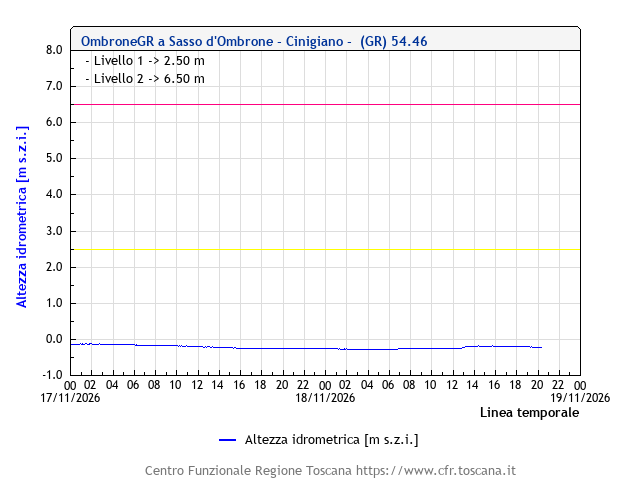
River level: Ombrone at Istia d'Ombrone (GR) 0.05 m
Click here to open the dedicated page for Istia d'Ombrone (GR).
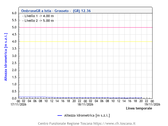
River level: Ombrone at Ponte Tura, Grosseto 0.77 m
Click here to open the dedicated page for Ponte Tura, Grosseto.

River level: Ombrone at Berrettino, Grosseto 1.34 m
Click here to open the dedicated page for Berrettino, Grosseto.
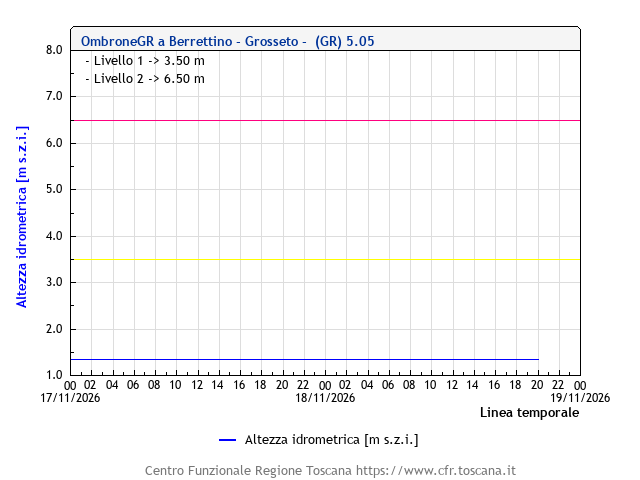
River level: Arbia at Pianella, Castenuovo Berardenga (SI) 0.41 m
Click here to open the dedicated page for Pianella, Castenuovo Berardenga (SI).
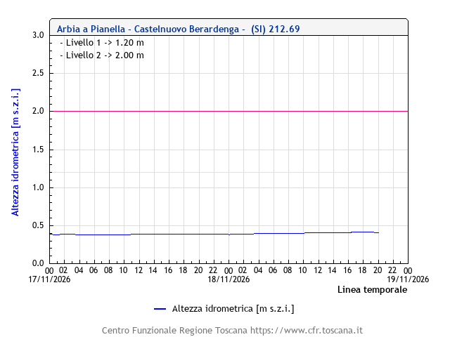
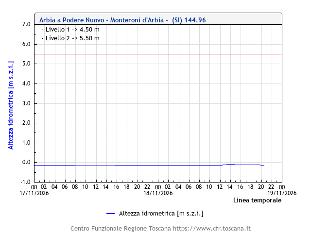
River level: Arbia at Podere Nuovo, Monteroni d'Arbia (SI) -0.12 m
Click here to open the dedicated page for Podere Nuovo, Monteroni d'Arbia (SI).
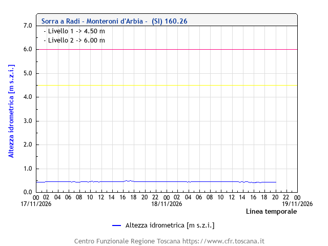
River level: Sorra at Radi, Monteroni d'Arbia (SI) 0.43 m
Click here to open the dedicated page for Radi, Monteroni d'Arbia (SI).
River level: Merse at Montieri (GR) 0.26 m

River level: Merse at Ponte Orgia, Sovicille (SI) 0.26 m
Click here to open the dedicated page for Ponte Orgia, Sovicille (SI).

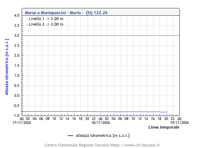
River level: Merse at Montepescini, Murlo (SI) -0.81 m
Click here to open the dedicated page for Montepescini, Murlo (SI).
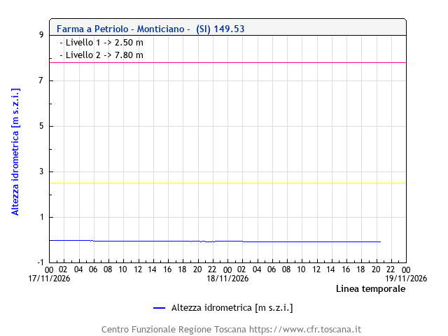
River level: Farma at Petriolo, Monticiano (SI) -0.08 m
Click here to open the dedicated page for Petriolo, Monticiano (SI).
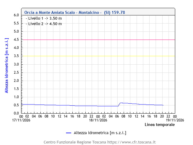
River level: Orcia at Monte Amiata Scalo, Montalcino (SI) 0.51 m
Click here to open the dedicated page for Monte Amiata Scalo, Montalcino (SI).
River level: Orcia at S. Angelo Cinigiano, Montalcino (SI) 0.03 m
Click here to open the dedicated page for S. Angelo Cinigiano, Montalcino (SI).
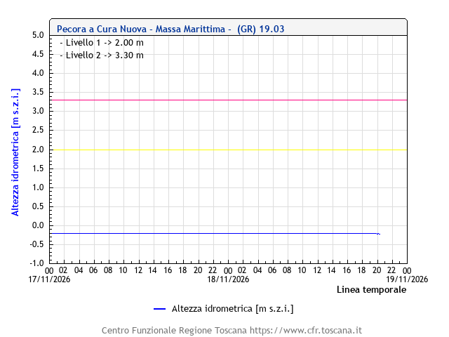
River level: Pecora at Cura Nuova, Massa Marittima (GR) -0.21 m
Click here to open the dedicated page for Cura Nuova, Massa Marittima (GR).
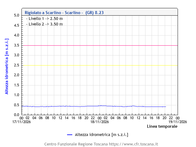
River level: Rigiolato at Scarlino (GR) 0.41 m
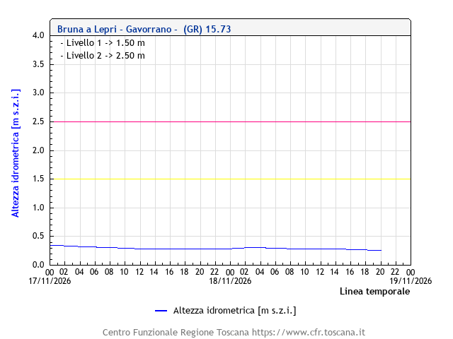
River level: Bruna at Lepri, Gavorrano (GR) 0.26 m
Click here to open the dedicated page for Lepri, Gavorrano (GR).
River level: Bruna at Castiglion della Pescaia (GR) 0.94 m
Click here to open the dedicated page for Castiglion della Pescaia (GR).

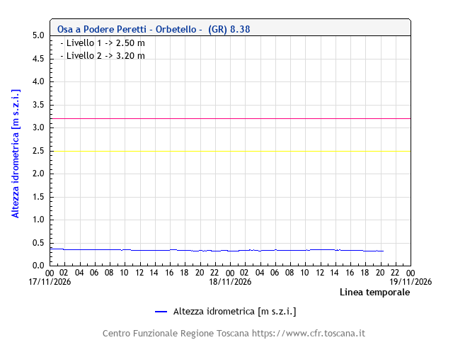
River level: Osa at Podere Peretti, Orbetello (GR) 0.33 m
Click here to open the dedicated page for Podere Peretti, Orbetello (GR).
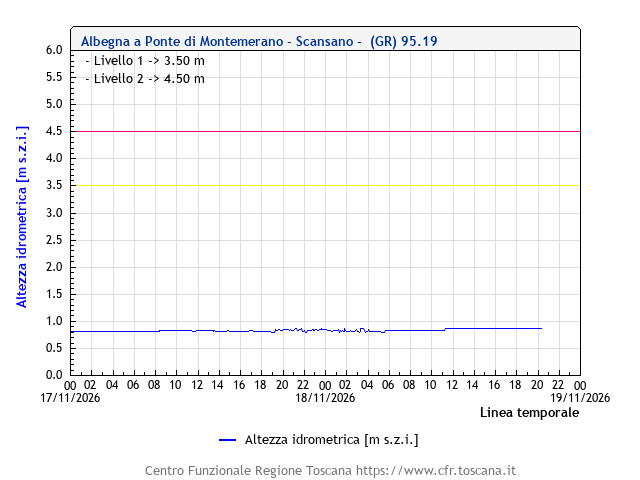
River level: Albegna at Ponte di Montemarano, Scansano (GR) 0.87 m
Click here to open the dedicated page for Ponte di Montemarano, Scansano (GR).
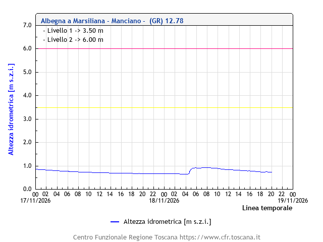
River level: Albegna at Marsiliana, Manciano (GR) 0.74 m
Click here to open the dedicated page for Marsiliana, Manciano (GR).
River level: Albegna at Amiatina, Orbetello (GR) 0.89 m
Click here to open the dedicated page for Amiatina, Orbetello (GR).

Monitoring stations in the basin of the Serchio river
Below are the charts of the hydrometric monitoring stations in the basin of the Serchio river.
River level: Serchio at Comporgiano (LU) 0.15 m
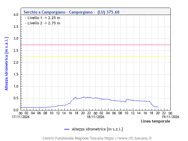
River level: Serchio at Ponte di Campia, Barga (LU) 0.05 m ↓
Click here to open the dedicated page for Ponte di Campia, Barga (LU).
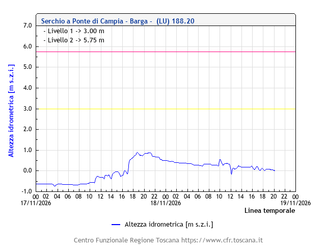
River level: Serchio at Calavorno, Coreglia Antelminelli (LU) 1.96 m
Click here to open the dedicated page for Calavorno, Coreglia Antelminelli (LU).

River level: Serchio at Borgo a Mozzano (LU) -0.66 m ↓
Click here to open the dedicated page for Borgo a Mozzano (LU).

River level: Serchio at Piaggione, Lucca 0.67 m ↓

River level: Serchio at Monte San Quirico, Lucca 0.84 m
Click here to open the dedicated page for Monte San Quirico, Lucca.
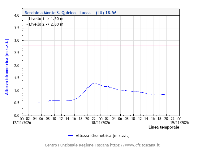
River level: Serchio at Ripafratta, San Giuliano Terme (PI) 2.06 m ↓
Click here to open the dedicated page for Ripafratta, San Giuliano Terme (PI).

River level: Serchio at Vecchiano (PI) 3.36 m ↓

River level: Serchio at Bocca di Serchio, San Giuliano Terme (PI) 0.84 m ↓
Click here to open the dedicated page for Bocca di Serchio, San Giuliano Terme (PI).
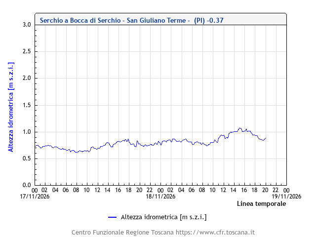
River level: Lima at Casotti, Abetone-Cutigliano (PT) 1.77 m
Click here to open the dedicated page for Casotti, Abetone-Cutigliano (PT).

River level: Lima at Ponte di Lucchio, Bagni di Lucca (LU) 1.62 m
Click here to open the dedicated page for Ponte di Lucchio, Bagni di Lucca (LU).
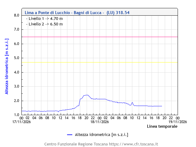
River level: Lima at Chifenti, Borgo a Mozzano (LU) 1.42 m
Click here to open the dedicated page for Chifenti, Borgo a Mozzano (LU).

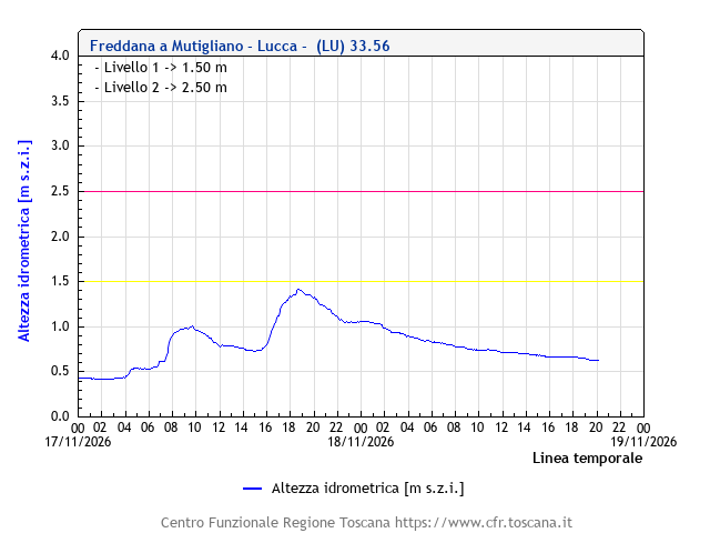
River level: Freddana at Mutigliano (LU) 0.63 m
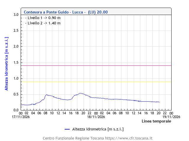
River level: Contesora at Ponte Guido, Lucca 0.27 m
Click here to open the dedicated page for Ponte Guido, Lucca.
River level: Ozzeri at Pontetetto, Lucca 0.04 m
Click here to open the dedicated page for Pontetetto, Lucca.
